Kitabı oxu: «The Men Who United the States: The Amazing Stories of the Explorers, Inventors and Mavericks Who Made America»

Copyright
William Collins
An imprint of HarperCollinsPublishers 77–85 Fulham Palace Road, Hammersmith, London W6 8JB
www.harpercollins.co.uk
First published in Great Britain by William Collins in 2013
Copyright © Simon Winchester 2013
Simon Winchester asserts the moral right to be identified as the author of this work.
A catalogue record for this book is available from the British Library.
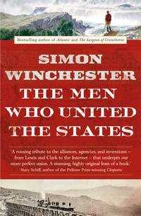
Original jacket design by Richard Ljoenes. Map courtesy of the Library of Congress. Front cover: (top) The Arrival of Captain Lewis at the Great Falls of Missouri, courtesy of the artist, Charles Fritz; (bottom) Trestle at Promontory, by Andrew J. Russell, from photographs taken during construction of the Union Pacific Railroad, Beinecke Rare Book and Manuscript Library, Yale University.
All rights reserved under International and Pan-American Copyright Conventions. By payment of the required fees, you have been granted the non-exclusive, non-transferable right to access and read the text of this e-book on-screen. No part of this text may be reproduced, transmitted, down-loaded, decompiled, reverse engineered, or stored in or introduced into any information storage and retrieval system, in any form or by any means, whether electronic or mechanical, now known or hereinafter invented, without the express written permission of HarperCollins
Source HB ISBN: 9780007532377
Ebook Edition © September 2013 ISBN: 9780007532384
Version: 2014-06-26
Praise
From the reviews of The Men Who United the States:
‘Simon Winchester is one of the quintessentially English writers who will go anywhere, literally and figuratively … because of his amateur status, boldness and decidedly nonacademic approach to history, [he] achieves something remarkable here’
Literary Review
‘Winchester understands that specificity is what counts, as it always does in writing … He has read prodigiously, and has pounded the trail with equal diligence’
Sunday Telegraph
‘This book’s cleverness lies in an organization neither chronological nor biographical, but elemental: there are five sections on wood, earth, fire, water and metal … This is an imaginative piece of historical writing, interwoven with memoir. But it is, in the end, more than either of those things: it is a love poem to the American landscape and to the spirit of people, now dead, who traversed it’
BBC History
‘Entertaining … A pleasure’
New York Times Book Review
‘Mesmerizing and fascinating … Winchester is a master storyteller, and all the individuals, places, and events that he passionately writes about come to life in exquisite detail … a magnificent achievement in writing, storytelling, and education’
New York Journal of Books
‘The fun here is in Winchester’s exuberant enthusiasm for his new country and for the characters he has found who helped shape it’
Washington Post
‘Vivid, valuable … Winchester’s book is especially fine on retrieving the forgotten map makers, geologists, topographers and engineers who showed them the way … what an extraordinary, propulsive tale he tells’
Wall Street Journal
‘Simon Winchester never disappoints, and The Men Who United the States is a lively and surprising account of how this sprawling piece of geography became a nation. This is America from the ground up. Inspiring and engaging’
Tom Brokaw
‘A very charming and meticulously researched celebration of America’s enduring unity and the various people and historical forces that have made it possible’
The National
‘An elegantly written account … filled with fascinating information’
Boston Globe
‘Another winning book from a historian whose passion for his subjects saturates his works’
Kirkus Reviews
‘Winchester masterfully evokes the excitement of the nation’s early days – when opportunity and possibility were manifest in uncharted mountains and new technologies – while bringing each of his subjects to life … the key to the book’s greatest achievement [is in] conveying the large-scale narrative of unification via the small-scale experience of the individual – the creation of a people by the agglomeration of persons’
Publisher’s Weekly
‘[His] writing style is a fortuitous juxtaposition of the rigors of scientific inquiry with the reporter’s keen eye for a good story. The happy result is this elegantly written and captivating meditation on the unique physiology of that cultural-political phenomenon known as the United States of America’
Washington Times
Dedication
February 23, 2012, was the eightieth birthday of my mother-in-law,
MRS. AKIKO SATO.
Shortly before the family celebration, I told her of my plan to structure my book around the five so-called classical elements. She briefly left the room, returning with this card on which she had handwritten this aide-mémoire for me, the five elements rendered in English, Chinese characters, and Japanese.

Three hours later, toward the end of her party, happy and surrounded by friends and family, Mrs. Sato collapsed and later died.
This card was thus the very last thing she ever wrote in her life—one ample reason among many for me to offer this book as dedication both to her daughter
SETSUKO
and, with gratitude and respect, to the memory of
MRS. AKIKO SATO.
Born, Tokyo, 1932. Died, New York, 2012.
May this small offering be her memorial.
Epigraph
Think of the United States today—the facts of these thirty-eight or forty empires solder’d in one—sixty or seventy millions of equals, with their lives, their passions, their future—these incalculable, modern, American, seething multitudes around us, of which we are inseparable parts!
—WALT WHITMAN, A Backward Glance o’er Travell’d Roads (PREFACE TO THE 1888 EDITION OF Leaves of Grass)
CONTENTS
Cover
Title Page
Copyright
Praise
Dedication
Epigraph
List of Maps and Illustrations
Author’s Note
Preface: The Pure Physics of Union
PART I: WHEN AMERICA’S STORY WAS DOMINATED BY WOOD, 1785–1805
A View across the Ridge
Drawing a Line in the Sand
Peering through the Trees
The Frontier and the Thesis
The Wood Was Become Grass
Encounters with the Sioux
First Lady of the Plains
High Plains Rafters
Passing the Gateway
Shoreline Passage
PART II: WHEN AMERICA’S STORY WENT BENEATH THE EARTH, 1809–1901
The Lasting Benefit of Harmony
The Science That Changed America
Drawing the Colors of Rocks
The Wellspring of Knowledge
The Tapestry of Underneath
Setting the Lures
Off to See the Elephant
The West, Revealed
The Singular First Adventure of Kapurats
The Men Who Gave Us Yellowstone
Diamonds, Sex, and Race
PART III: WHEN THE AMERICAN STORY TRAVELED BY WATER, 1803–1900
Journeys to the Fall Line
The Streams beyond the Hills
The Pivot and the Feather
The First Big Dig
The Wedded Waters of New York
The Linkman Cometh
That Ol’ Man River
PART IV: WHEN THE AMERICAN STORY WAS FANNED BY FIRE, 1811–1956
May the Roads Rise Up
Rain, Steam, and Speed
The Annihilation of the In-Between
The Immortal Legacy of Crazy Judah
Colonel Eisenhower’s Epiphanic Expedition
The Colossus of Roads
And Then We Looked Up
The Twelve-Week Crossing
PART V: WHEN THE AMERICAN STORY WAS TOLD THROUGH METAL, 1835–TOMORROW
To Go, but Not to Move
The Man Who Tamed the Lightning
The Signal Power of Human Speech
With Power for One and All
Lighting the Corn, Powering the Prairie
The Talk of the Nation
Making Money from Air
Television: The Irresistible Force
The All of Some Knowledge
EPILOGUE
Footnotes
Bibliography
Searchable Terms
Acknowledgments
About the Author
Also by Simon Winchester
About the Publisher
MAPS AND ILLUSTRATIONS
Illustrations noted as “(pd.)” are in the public domain.
1. The five classical elements. (Lettering by Mrs. Akiko Sato; courtesy of the author)
2. The Point of Beginning, East Liverpool, Ohio. (Courtesy of the author)
3. The B-2 bomber squadron at Whiteman Air Force Base. (Courtesy of the US Department of Defense, photograph by SrA Jessica Kachman, June 1998)
4. William Maclure in New Harmony. (Painting by Thomas Sully, courtesy of the Academy of Natural Sciences, Ewell Sale Stewart Library, Drexel University)
5. Maclure’s geological map of the United States. (Courtesy of David Rumsey Map Collection, www.davidrumsey.com)
6. Gouverneur Warren’s 1858 map. (Courtesy of Derek Hayes)
7. John Wesley Powell. (Courtesy of the Library of Congress)
8. Steamboat Rock. (Courtesy of the author)
9. The Grand Canyon of the Yellowstone (Painting by Thomas Moran, 1893; courtesy of the Smithsonian American Art Museum, Washington, DC/Art Resource, NY)
10. Clarence King in the field. (Courtesy of the US Geological Survey Photographic Library)
11. Ada Copeland (also known as Mrs. King or Mrs. Todd) with her son Wallace. (Courtesy of the New York Daily News)
12. The Youghiogheny River. (Courtesy of the author)
13. A column by “Hercules” in the Genesee Messenger. (Courtesy of The New-York Historical Society)
14. “Wedding of the Waters” ceremony, New York. (Copyright 1905, C. Y. Turner)
15. Asian carp. (Courtesy of Nerissa Michaels)
16. The Chancellor Livingston. (Courtesy of The New-York Historical Society)
17. Donner Pass. (pd.)
18. On the 1919 motor convoy. (Courtesy of the National Archives)
19. The “Good Roads Train.” (Courtesy of Project Gutenberg)
20. Thomas MacDonald. (Courtesy of the Library of Congress)
21. “Good Roads Everywhere” map. (Courtesy of Derek Hayes)
22. Map of the Interstate Highway System. (Courtesy of Derek Hayes)
23. Opening of the I-94, in Wisconsin. (Courtesy of the Wisconsin Historical Society)
24. Cal Rodgers. (Courtesy of Stephen White)
25. Cal Rodgers’s plane. (Courtesy of Stephen White)
26. Farny’s The Song of the Talking Wire. (Courtesy of the Taft Museum of Art, Cincinnati)
27. Samuel Morse’s patent, No. 1,647. (Courtesy of the US Patent Office)
28. Samuel Morse sending the first telegraph message. (© Bettmann/CORBIS)
29. Telephone wires in New York City. (Courtesy of Stephen White)
30. Electricity demonstration. (Courtesy of Stephen White)
31. Nikola Tesla. (pd.)
32. “PWA Rebuilds the Nation” poster. (Courtesy of David Rumsey Map Collection, www.davidrumsey.com)
33. Reginald Fessenden and his transmitter lab. (pd.)
34. Family grouped around a radio receiver. (Courtesy of Stephen White)
35. Johnny Carson. (pd.)
36. Joseph Licklider. (pd.)
37. Vint Cerf. (Courtesy of Joi Ito, 2007)
38. Robert Kahn. (pd.)
39. Google server farm. (Photograph by Connie Zhou; courtesy of Google)
AUTHOR’S NOTE
On Independence Day, July 4, 2011, I swore a solemn oath before a federal judge on the afterdeck of the warship USS Constitution in Boston Harbor, and by doing so I became, after half a century of dreaming, a naturalized American citizen. The following day I acquired my voter’s registration card; a week later I was issued my first American passport, a document on which I have traveled ever since. When I returned to Kennedy Airport after my first trip overseas as an American, I was little prepared for my reaction when the immigration officer remarked with casual warmth, “Welcome home.” I felt almost overwhelmed by at last now being a part of all of this.
The most recent design of an American passport incorporates a series of declarative epigraphs at the top of each visa page. Samuel Adams: “What a glorious morning for our country.” The inscription on the Golden Spike at Promontory Summit in Utah: “May God continue the unity of our country as the railroad unites the two great oceans of the world.” And Jessamyn West’s description of the railway as “A big iron needle stitching the country together.”
But of all the quotations, the one I like most is a paragraph taken from Lyndon Johnson’s inaugural address of January 20, 1965. The nation was at the time still shocked by the tragic shooting of President Kennedy—the event that elevated LBJ to the presidency. The country, still mired in Vietnam, was in a liverish mood, and many more tragedies were yet to come. But Johnson, seeking by his speech to help salve the country’s wounds and to better the temper of the times, spoke in an optimistic vein:
For this is what America is all about. It is the uncrossed desert and the unclimbed ridge. It is the star that is not reached and the harvest sleeping in the unplowed ground. Is our world gone? We say “Farewell.” Is a new world coming? We welcome it—and we will bend it to the hopes of man.
The pages that follow are devoted in large part to those men who, in the overarching interests of welding the nation together, traversed those uncrossed deserts and scaled those unclimbed ridges, offering in their own times and their own ways the promise of a better place and of better times ahead.
PREFACE: THE PURE PHYSICS of UNION
E pluribus unum.
—SINCE 1782, THE MOTTO ON THE OFFICIAL SEAL OF THE UNITED STATES
Early in the crisp small hours of November 7, 2012, a weary but exultant Barack Obama was thanking his countrymen for just handing him a second term as forty-fourth president of the United States. His speech was brief, but it rang with an eloquence that moved well beyond the platitudes of the pitiless election season that had mercifully ended in this culmination just moments before.
It was a speech that spelled out President Obama’s unyieldingly optimistic belief in the future of a country that had allowed him, a young black man, to be invested, now for a second term, as the most powerful human being on the planet. He had been given this role, he said, with a new chance to perfect still further the immense entity that is the American union, more than two centuries after his country had declared its independence from colonial rule.
Such was the crowd’s exuberance that much of what the president said was drowned in a cacophony of cheering and frenzied delight. Sensing the mood, he prudently kept what he had to say brief and to the point. After no more than ten minutes of high rhetoric, the tone of his voice fell and quieted—he was coming to the end.
“I believe we can seize this future together,” he said, “because we are not as divided as our politics suggests. We’re not as cynical as the pundits believe. We are greater than the sum of our individual ambitions, and we remain more than a collection of red states and blue states. We are and forever will be”—and here he paused for just a beat, to add solemn emphasis to the adjective—“the United States of America.”
The United States. This unique national quality—of first becoming and then remaining so decidedly united—is a creation that, in spite of episodes of trial and war and suffering and stress, has been sustained for almost two and half centuries across the great magical confusion that is the American nation. The account that follows, then, is on one level a meditation on the nature of this American unity, a hymn to the creation of oneness, a parsing of the rich complexities that lie behind the country’s so-simple-sounding motto: E pluribus unum.
America is, after all, a nation founded as a home for the single simple ideal of universal human freedom. The country was established as a grand experiment, with people invited from all over the world to take part, to help build a nation of free souls, each to be given an equal opportunity to seek as each saw best the greatest happiness for themselves. The question I try to address in the following chapters is: just how has it managed to adhere, to keep itself annealed into one for all the years and decades since?
Unity among peoples, in a country as complicated as America, is just not an organic thing. In countries with less convoluted pedigrees it might well be. By way of analogy, people in tribes tend toward natural unity—whether they are Kikuyu, Comanche, Wurundjeri, or Micmac, individuals within each tribe bond together tightly. Clans in Scotland are proud of being firm-welded entities of great antiquity—all McKenzies and MacNeils are one, Scots like to say, whether fortune or happenstance has led them to be dukes or dustmen. Elsewhere class and the tendency toward an intellectual aristocracy have magnified a sense of union—Etonians, graduates of Hotchkiss and Science Po, Harvard and Christ Church may all bond clubbably, as may most European marquesses and counts or their American equivalents, the Biddles, Lowells, Cabots, and Saltonstalls. Race likewise has an annealing affect: Harlem and Hough and Watts and a score of other places have long offered local concentrations of great resilience, strength, and pride.
But America as a whole, once its early Puritan settlement had been diluted by those who followed or those already there, became too much of a mongrel nation to enjoy the simpler organic benefits of union. Lacking the communal simplicities afforded in some other countries—Japan, say, or Norway—by the existence of one race, one ethnic group, or a single class or a dominant intellectual or spiritual tendency, the great experiment that is America has had to make a union for itself, not wish it to grow in the dark out of time and nothing. It has done so purposefully by the deliberate acts of its own people. Man has had to do the hard work in bringing America together, forging something that in other, less complex places has been accomplished much more simply.
And surely all must agree that man in America, bent to this single task, has done most creditably. Excepting of course the tragic period in the 1860s when the union was so cruelly tested by civil war, this work has been performed with a consummate degree of success. The states are now generally united, and as a body united, the nation has enjoyed a steady growth of prosperity and power known by no other country on earth. And all the while, the American people have managed to remain staunchly together while countries in so many rival regions around the world—in Europe, Russia, China, and India—have been plagued by bickering and struggling and division, and have been rendered much the lesser thereby.
But just how has America’s uniquely stable union been achieved? What factors have ensured that, say, a Chinese migrant in rain-swept Seattle can find himself locked in some near-mystical concord with a Sephardic Jewish woman in Manhattan or a Cherokee student in Minnesota or a Latina stallholder in a market in Albuquerque—all of them being able to enjoy the same rights and aspirations, encapsulated in their shared ability to declare so simply, I am an American?
How did the notion of creating a more perfect union of such peoples and of such administrative entities—the now fifty states, comprising the 2,955 counties of forty-eight of them, the 64 Louisiana parishes, and the 18 Alaska boroughs—first come about? And how did this idea of union translate into the practical, physical, and concrete terms we know today, which have worn so well and lastingly?
The main purpose of the pages that follow is to consider what might be called the physiology and the physics of the country, the strands of connective tissue that have allowed it to achieve all it has, and yet to keep itself together while doing so.
For the ties that bind are most definitely, in their essence, practical and physical things. It would of course be idle to dismiss the adhesive nature of the ideas on which the nation was founded. It would be a grave mistake to forget that the guiding national concept is based on a set of common purposes, on ideals and constitutionally guaranteed freedoms that are so publicly cherished by all. But over the years, these inchoate things have all been of necessity underpinned by innumerable real, visible, tangible connections—by survey lines and marks; by roads; by canals; by railways, telephone lines, power grids; and, more recently, by submerged rivers of electrons—all of which have proved crucial both in maintaining the union and in preventing, or at least lessening the likelihood of, its fracturing and spinning into a thousand separate parts.
This book tells the story of making such connections as these and of the remarkable and visionary figures from the country’s history who first made them.
Most of them were already Americans when they did so. Though we might nowadays wish it were otherwise, most—but not all—were men. Most of their achievements—but not all, most especially that which permitted the private ownership of land—were made after the Louisiana Purchase, which suddenly doubled the country’s size into the truly transcontinental entity it is today. Most of their achievements—but not all—remain as vital to the nation’s preservation as they were when first they were created.
From the very visible nineteenth-century explorations of the Lewis and Clark expedition, by way of the geological surveying expeditions and the highway-building ventures and waterway excavations, to the less easily describable twenty-first-century mystery makings of the Internet communications backbone—there are fully two centuries of inventive zeal that have left as legacy a nation now as comprehensively interconnected and as practically unified as it is possible to imagine.

But how best to organize the wealth of work that has brought about this unity? The sheer complications of it all—the overlappings of the work of road builders and survey makers, of the pioneers of flight and the makers of radio, of the work of those who dug canals and those who excavated the tunnels for the railroad lines—made it well-nigh impossible to narrate the story in purely chronological terms. By the same token, to list the characters who were involved in the forging of the union would lend the account the feel of a catalog or an encyclopedia. A device was needed, it seemed to me, that would link the achievements thematically and give the story some greater degree of structure and logic.
An idea came to me one morning when I was writing a letter to a friend in China.
Beginning in the mid-1970s, I had lived for many years on the far side of the world and had spent much time tramping the territories between Vladivostok and Vietnam, between Manchuria and Malaysia, and between Kashmir and the Khyber Pass. All the countries of Asia—as well as the ancient civilizations of the Mediterranean—had held for centuries a philosophical view that everything and everyone can be reduced to the barest essentials, the five so-called classical elements. While the ancient Greeks revered just four elements, most other civilizations, from India eastward, nominated five.
The various eastern countries in their histories have made subtle variations in just what these five elements are, but those most commonly selected are wood, earth, water, fire, and metal. While I was writing the letter to my friend in Shanghai that day and explaining the idea behind the book, it suddenly seemed to me that the five elements could be a logical way of placing into context the basic themes behind the making and joining together of the United States.
The earliest explorers of the country, for example—Lewis and Clark and all the others in the years immediately following—were confronted by endless stands of ancient forest. Despite the myths, these forests were seldom as impenetrable as those in Russia or the tropics: Native Americans regularly set fires to manage and to thin them, to create pasture and to make usable landscape. But they were woods nonetheless, and they were vast and ancient.
The early explorers paddled through them and up and along the various rivers of their expeditions in wooden boats. In winter and at night, they kept themselves warm by building fires of oak and ash wood. They framed their earliest houses of timbers of cedar and pine.
Wood, in other words, could be claimed as an abiding elemental theme of their voyage of discovery, and it would go on to be a dominant feature of every subsequent early voyage across the country. Wood, then, could provide an overarching theme for a chapter that considered these first explorers and settlers, an emblem of the frontier in the forested wilderness that was the American continent.
Once the basic geography of this continent had been established, there came the equally vital task of learning what riches might lie beneath the woodlands and the carpets of vegetation. Geologists—men who were quite unschooled at first but highly sophisticated in later years—began to probe for the mineral riches and determine the agricultural worth of the land, the value and potential of the earth. The vision of mineral treasures lying locked within those millions of acres, or the possibilities of fertile farmland for crops or livestock, and of livelihoods to be made from raising them, would in due course lure out the settlers and prompt their treks westward into a country that was now established to be blessed with the promise. The earth and its riches, in short, would offer a second theme well worthy of exploring.
And the remaining three elements—water, fire, and metal—prove equally suited to this broader organizing principle.
Water, for instance. There is no gainsaying the use of the country’s rivers and streams as early highways and the later employment of these waterways for trade, for the making of power, for the creation of frontiers. Then, if the waterways were not wide enough or deep enough or straight enough, there came the making of artificial rivers—the canals—which might ease the passage of people and goods across mountain chains. For scores of decades, right through to today, there are stories to tell of figures who were prominent in such unifying endeavors, which could all be linked by the essential element of water.
After or overlapping with these stories, there came the invention of the engines and the concept of employing these engines as agents of motive power. The common physical feature of all such early engines was the employment of heat; whether they were powered by steam, gasoline, or aviation fuel, these engines would eventually allow the country to be journeyed across swiftly, expeditiously, and easily. The nation could now be intimately linked along roadways and highways traveled by a variety of contraptions, all powered by fire.
Finally: metal. The copper cable of the telegraph, the steel wire of the telephone, the iron mast of radio and television, the subterranean and aerial titanium and cadmium and platinum mysteries of the Internet—the elemental common denominators of the transmission of information might be varied indeed, but in the terms of the ancients, metal was the common factor. Metal was key.
Armed with this basic notion, I set off for several months of exploration. Like a mantra, the words wood, earth, water, fire, and metal became a phrase, repeated over and again, that lay always in the back of my mind as I traveled back and forth between the coasts and crossed the prairies and the mountain ranges of the United States.
I equipped myself for the journey with tent and compass and sleeping bag, as well as numberless maps, books of history, and novels by the classic writers of the American experience: Willa Cather, Wallace Stegner, John Williams, Theodore Dreiser, Sinclair Lewis, Sherwood Anderson. And as vade mecum, I also managed to collect all fifty volumes of the American Guide Series—the famous WPA Guides, still among the most thoughtfully composed and intelligently edited books about the individual states.
The books date back to the late 1930s and were each assembled, as part of President Roosevelt’s New Deal, in a federal government effort—the Federal Writers’ Project—to give work to unemployed authors, journalists, and photographers. Though as sources of precise travelers’ information, they are long past their sell-by date, their essays still have a sustaining importance, and they offer wise counsel and a grand perspective for anyone wishing to venture into the great American hinterland.
The WPA guides—government-made books, it has to be remembered—offer a reminder of a highly divisive argument about the making of America: the role of government in the creation and sustenance of human society.
That is not to say that in these pages I wish to offer an uncritical apologia for the concept of big government. Far from it. There are all too many examples of unforgivable excesses. The savage and divisive melancholy of the Trail of Tears was, after all, a consequence of overzealous government behavior toward America’s own native peoples, with results that ran entirely counter to the principal thesis of this book. The amassment of vast armories of atomic weapons, the involvement of the United States in scores of cruel and unnecessary foreign wars, the lunacies of Prohibition, of the Tuskegee experiment, of the infamous MK Ultra program, and of the fully legislated and half-century-long antipathy to Chinese immigration—all of these and more were the acts of a government that had simply become on occasion too big for its boots.
Yet there was much good done, too, and not a little of it was and still remains on display in the telling of this story. Without an engaged and functioning federal government, the development of these various strands of the country’s connective tissue would probably have been either delayed or never achieved at all. That is why my reading of the WPA Guides provided me with a symbolic madeleine, a means of remembering a single sobering fact: while today’s political hostility to big government is an understandable reality of contemporary life, the historic role of big government in the creation of the American nation is a reality, too, one that might as well be acknowledged and celebrated for its value and great worth.
The first two volumes of the series that I decided to use were published in 1940 and 1941, respectively: the first was devoted to Ohio; the other, to Missouri. I took them along because I had decided to travel first to a pair of places that seemed to me to have played crucial roles in the making of a united America.
Each town stands on the right bank of a great American river, and in each case the river gave its name to the state in which the town is situated. The first town was East Liverpool, which is both in Ohio and on the Ohio; the second was Saint Charles, which likewise is both in Missouri and on the Missouri. Neither place is especially well known, whatever its chamber of commerce might say. The importance of each has faded over the centuries. Neither seems to me lovely enough to attract many visitors.
But each town was once most important to the man who originated the idea of creating a properly United States of America, a Founding Father who would go on to be the country’s third president, Thomas Jefferson. And each town now has a fine-looking memorial—in one case a plaque, in the other an obelisk—to the events that occurred there and helped make each community briefly famous.
Both memorials are now surrounded—and in the case of one of them, half hidden—by trees. A reminder, if any were needed, that at the time Thomas Jefferson gave these places their brief significance in making the physics of the union, America was a land swathed by long reaches of barely penetrable forest, most of its mysteries still half hidden by wood.
PART I
I never before knew the full value of trees. My house is entirely embossomed in high plane-trees, with good grass below; and under them I breakfast, dine, write, read, and receive my company. What would I not give that the trees planted nearest round the house at Monticello were full grown.
—THOMAS JEFFERSON, LETTER TO MARTHA RANDOLPH, 1793
… I was not prepared to see the pine timber so valuable and heavy as it is above and about here. The trees are of large growth, straight and smooth … With the exception of swamps, which are few and far between, the timber land has all the beauty of a sylvan grove. The entire absence of underbrush and decayed logs lends ornament and attraction to the woods. They are more like the groves around a mansion in their neat and cheerful appearance; and awaken reflection on the Muses and the dialogues of philosophers rather than apprehension of wild beasts and serpents.
—CHRISTOPHER COLUMBUS ANDREWS, Minnesota and Dacotah, 1856
A VIEW ACROSS THE RIDGE
Thomas Jefferson was a man with a lifelong fascination with trees. He thought of them as his favorite kind of plants, wrote of them as his pets, and went to much effort and expense to place those he liked best around the great west lawn of Monticello, the house he made for himself in the foothills of the mountains of Albemarle County, Virginia.
He was an extravagant man, given to extravagant visions—which Monticello’s present-day garden conservators have done much to reproduce. So just as he wished when he first bought Monticello in 1768, there are today long allées of willows, great terraces of magnolias, and stands of sugar maples. There are linden trees, mulberries, and honey locusts; there are oaks and pines and pecans, catalpas and gingkoes and chestnuts, sycamores, walnuts, slippery elm, and Osage orange and border plantings of persimmons, black gums, and fruit-bearing peach trees.
Monticello’s fortunes have fluctuated dramatically over the years—not least because the third president’s excesses left the estate hopelessly mired in his legacy of debt. For many decades the house itself was a magnificent ruin, the estate gardens were left to run wild, and the surrounding forests were choked with underbrush. Some of the greater trees survived the rigors of time and neglect, however, and in recent years it became something of a sport to try to say with certainty which of these gnarled monsters Jefferson himself might have planted. It somehow made the country’s best-beloved Founding Father ever more human to imagine him out in the garden on a summer’s evening, digging the saplings deep into the hilltop’s rich loamy soil, to think of him spreading mulch above their roots and then leaving the shoots to the soothing balms of warm Virginia rains.
An X-ray device invented by a Dutch arborist was recently brought in to work out the age of the nobler-looking trees, and there was much exultation on the mountain when four of them could be proved to be at least two hundred years old—and thus quite old enough to have been planted by Jefferson. But irony has no respect for antiquity: no sooner had these trees been identified as most probably the work of the man himself—or the small army of slaves he had working on his estate—than all four of them keeled over and died.
Two of them were massive but fragile tulip poplars, one of which was fully ten yards around at its base and had begun to pose a dire threat to the building beside it. The others were a larch and a copper beech, immense shade trees under which the aging Jefferson was said to have whiled away many of the afternoons of his latter days. To most there was a gentle poignancy in their passing, because it severed one certain and romantic connection with the man who, above all others, still stands today as the architect of most of the central ideas behind the making of the United States.
But one other connection, a small and little-noticed arboreal conceit at Monticello, also links the man and his vision—and quite literally his vision—with those who visit today. It is a small and cleverly created spy hole in the woods that surround Monticello, and it affords visitors a subtle view of their surroundings that in its own way is every bit as inspirational as that which Jefferson, in laying out the plans for his estate, had once designed for himself.
Monticello faces almost exactly to the west. Were it not for one low hillock in between, Jefferson would have been able to contemplate an uninterrupted panorama clear across to the Blue Ridge Mountains, thirty miles away. The 1,200-foot Montalto—on top of which he once planned to build an observation tower but never did—does slice off some of the ridge’s more southerly aspect. But only a little. Otherwise the view was unobstructed. The trees Jefferson planted around his lawns had not in his lifetime grown tall enough to be much of a barrier, so that toward the end of his life he could sit on his porch and watch the sunset over the distant folds of hills, with only Montalto slightly in the way.
Today, however, this is no longer true. The trees have grown high, and someone sitting where the president liked to take his evening ease could no longer see in the summer his blue remembered hills. Instead he would be confronted by a mighty wall of green—or in October, when the trees take on their autumn colors, a tableau of brilliant yellows and reds and oranges. The view might well be chromatically beautiful, but because of the sheer number of fully mature trees that have sprung up today, it is not at all what Thomas Jefferson saw.
Those who run Monticello today have long sought to re-create the estate just as it was in the fifty-eight years it was his home, views and all. To help achieve this, they have cut a spy hole in the trees. By judiciously pruning and carefully planning, the foresters have cut in the faraway wall of oaks and hemlocks and white pines what looks like a tiny eye-shaped rent—though up close it is a hole probably measuring a good twenty feet by ten, at least. By careful cutting back and shaping, they have managed to keep it clear year after year—with the result that it is quite possible to squint through it and see, or at least to glimpse briefly, a fraction of what Jefferson saw.
Because Jefferson was most especially proud of having created the University of Virginia, the tree cutters and spy-hole makers have managed to frame its great rotunda, which Jefferson did not live to see finished, in the dead center of the view. Behind, though, are the soft, wood-smothered hills, with the sinuous curves of the Skyline Drive and the Blue Ridge Parkway marking their summit lines. These are hills with a special significance in American history and in the story of the eventual unification of the country. For in Jefferson’s time these hills toward which he gazed marked the outer limits, the western edge, the border of the pale of properly settled America. They were a line of hills which Jefferson never managed to cross but which intrigued him, pulled at him, and nagged at him all his life.
DRAWING A LINE IN THE SAND
There are a great many aspects of Jefferson’s character that led him to play so crucial a part in the physical creation of the eventual transcontinental republic. It is a commonplace to repeat that he was a man of contradictions. He was a scientist, first and foremost, as well as a learned aesthete and a slave-owning aristocrat with apparently profound feelings for the furtherance of human decency, kindness, and civilization. At thirty-two years old, he was described by the überbiographer James Parton as “a gentleman … who could calculate an eclipse, survey an estate, tie an artery, plan an edifice, try a cause, break a horse, dance a minuet and play the violin.”
There was something else though. Thomas Jefferson may well have been a sophisticated foreign traveler—he had been minister to France, after all, and later for four years was the US secretary of state—but his travels within the republic were limited indeed. And yet for most of his life, he was quite enthralled by the concept of the American West. He suffered from a bewildering, almost uncanny, and romantic fascination with the continental Occident. He was obsessively interested in particular in just how its immense and generally unknown acreage could and should eventually be apportioned among his country’s fast-growing citizenry.
To know its geography was a first imperative. As far back as 1783, while he was a Virginia member of the Continental Congress, he had formally suggested the mounting of a private expedition to the Pacific. “I have always had,” he declared, “a peculiar confidence in men from the western side of the mountains.”
But Jefferson did not mean by this the grand crystal crags of the Rockies or the Sierra Nevada (of which he, in common with most, knew precious little). Rather he meant the relatively modest ripples of the Appalachians, of which the Blue Ridge hills that he could see from Monticello were the easternmost. For these endless ridges of Devonian rock that rose out of the coastal plains from South Carolina up to New York essentially marked the edge of the United States proper, in Jefferson’s time. Beyond them, America was barely known.
Five million people (a fifth of them black, mostly enslaved) lived within fifty miles of the Atlantic Ocean, hemmed in by these confusing swaths of mountains. Only four dirt roads pierced the passes between the hundreds of miles of ranges. Poor weather, frequent rockfalls and mudslides, or else the occasional understandable hostility of the Creek, the Iroquois, or the Cherokee who once owned these lands (to the extent the ownership of land was a concept recognized by indigenous Americans) increased the difficulty for settlers wishing to travel across the hills, between South Carolina and Kentucky, say, or from Tennessee to Pennsylvania. As late as the middle of the nineteenth century, it could still take nine days of fitful journeying by railroad, canal, riverboat, and stage line to get from New York across to Pittsburgh, because these Appalachian ranges were so ruggedly impenetrable. In Jefferson’s time, travel across them was for the fainthearted all but impossible.
Those scattered few who then lived permanently beyond this cordillera, those whose homes were south of the Great Lakes and down in the Ohio Valley, turned out to be so decisively cut off from the American mainstream that there was serious talk of secession, though in the end it came to little more than campfire grumblings. Meanwhile those who lived farther out still, in the wilds beyond the Ohio River and in the American-possessed (but hitherto Indian-reserved) lands that were then designated as the Northwest Territories, were as scarce as they were brave. They may have enjoyed Jefferson’s “peculiar confidence,” but they were initially outnumbered ten to one by Native Americans; they had extremely limited opportunity for work, mainly in the fur trade; they were protected, but only somewhat, by outpost contingents of American soldiers; and they lived under a scrappily benign version of martial law. It was only when their numbers reached five thousand—in 1798, two years before Jefferson became president—that they were given a representative government with a proper little parliament sited in the first instance in Marietta, the tiny town that was their territorial capital.
It was these doughty western settlers who were to become, however, the eventual first beneficiaries of one of the greatest and most revolutionary ideas put forward by Jefferson, as the territory in which they eked out their rugged existences became its initial testing ground. Jefferson’s great notion was that Americans could and should have the right to do something that was hitherto quite unimaginable to the Indian tribes: they should be able to own the land of which their territory was made.
Land ownership was an unfamiliar and almost alien concept. Bands of the Iroquois, the Creek, the Shawnee, the Delaware, the Miami, and their native kin had certainly passed through these lands for hundreds of years, had hunted it, settled it, raised families on it. But they had never imagined it as something that could be possessed. It was much the same for the early white settlers: they may not have had the same nomadic urges as the Shawnee and the Iroquois, but land ownership was conceptually well beyond their ken also. It might have seemed possible and reasonable for a settler to own a canoe or a cow or a cottage—or back in those unenlightened times in the Americas, even a slave. But land, an immovable part of the eternal fabric of our celestial body—that seemed somehow to be an entity beyond ownership, the possession of it lying perhaps within the divine prerogatives of kings but certainly not ever in the name of ordinary citizens.
Thomas Jefferson thought quite otherwise. He had developed this thinking long before completing his work on the Declaration of Independence. It is spelled out in a sulfurous pamphlet, published in 1774, in which he denounced King George III’s plan that American colonists on the far side of the Appalachians should live in a feudal arrangement, with the king owning the land and his tenants obliged to pay their feu to his court.
The thirty-one-year-old Jefferson denounced this as a barbarism. It was a formula for studied inequity, based on a fiction of kingly and ecclesiastical privilege that had been developed in Britain a thousand years before by the Norman conquerors and believed by many in the homeland ever since. Jefferson declared that such a concept—that only kings, churches, and the aristocratic mighty could own land—would not be allowed to infect the vast tracts of real estate that he suspected lay on the far side of his new country’s mountain ranges. All men should have, in his opinion, the right to own land there as they see fit—to buy, sell, or borrow against its value and to hand it down over the generations. And to pay taxes on it, moreover, from which good governance might be purchased and paid for.
This belief had helped propel Jefferson into his seat in the Continental Congress. And his unwavering devotion to its principles led to his sponsorship, a decade later, of a new law, the practical effect of which can be seen nowadays in just about every American town and city beyond the East Coast and on just about every field west of the Ohio River. This was Jefferson’s Land Ordinance of 1785—An Ordinance for Ascertaining the Mode of Disposing of Lands in the Western Territory—a piece of legislation that laid down the rules for how the immense tracts of new American countryside, at the time neither owned nor properly known, were to be described, divided, and eventually distributed.
Though a dreamy Jeffersonian idealism lay at the legislation’s heart, this prescient and profoundly significant piece of legislation not only provided land for those who wished to own it, but also raised money for a new government that was financially exhausted and depleted by the war with the British. The western lands were the new nation’s greatest physical asset—albeit an asset taken without regard for the Native Americans who inhabited them. The new government could sell these lands, in parcels, to anyone who had the wherewithal to buy them. So Jefferson’s ordinance set out principles for creating the parcels. Most crucially, it laid down the requirements for a survey, for the creation of a grid of meridians and baselines from which to create these parcels.
To start the process, there also had to be established a place where the surveys of western America would be formally begun, a place that was then touchingly named, as it remains named today, the Point of Beginning.
The honor of locating this point went to Ohio—or what would later become Ohio, the crucible of the Old Northwest. The point can still be seen today, just. It is on the outskirts of a grimy industrial town called East Liverpool, close to a family firm named S. H. Bell, which processes, crushes, and screens, as well as stores and ships, many of the basic materials of the country’s industrial lifeblood—bricks, wire, cement, oil-fracking sand, pig iron, steel billets, fertilizer, and limestone. Here, at the point where Pennsylvania becomes Ohio—and 1,112 feet north of where, a few score yards out into the river, a slim tongue of West Virginia licks its way between—is the monument which, though it doesn’t exactly say so, truly is a memorial to these two most Jeffersonian ideas, private land ownership and public westward expansion.

From near this unlovely spot, beside a railroad line and an industrial storage yard outside East Liverpool, Ohio, all of western America is still measured. The obelisk marks the Point of Beginning, the origination site for the meridian and baseline used since the first surveys of the nation.
It is a cement stele, about chest high, sitting on a circular stone mat on which are engraved the four cardinal compass points. The monument is a four-sided obelisk, not unlike the very top of the Washington Monument, with suitably portentous inscriptions on each side. Few of the motorists hurtling by on state highway 39 bother to stop to read, even though the obelisk is surrounded by a small copse of other cast-iron markers and stone boundary posts, and by rights it should be most alluring. It is indisputably one of the more historically significant sites in the nation, a place that should have tour buses and fountains of cool drinking water, even a souvenir stall. Instead it sports a scruffy parking space, one forlorn utility pole, and a scattering of litter.
Jefferson’s name is not there; instead the marker notes that “On September 30, 1785, Thomas Hutchins, first Geographer of the United States, began the Geographer’s Line of the Seven Ranges.” Mr. Hutchins was very much Thomas Jefferson’s man, a keen supporter of the distant vision of the American West as an immense “empire of liberty.” He was a soldier, a cartographer, and the architect of a system of surveying that continues to be employed in America to this day.
Taking this arbitrary spot as his starting point, he drew lines—one north and south, the meridian; another at right angles to it, the baseline. Once having determined, with the use of sextants and star charts and chronometers, the precise longitude and latitude of the site—40° 38′ 33″ North of the equator, 80° 31′ 10″ West of Greenwich—he then set off with his rolls of twenty-two-yard-long iron Gunter’s survey chains,1 then later with his theodolites and compasses and plane tables, and his party of army-protected cartographers, to survey America.
And by America, Hutchins meant the entire continent, though at that time the nation extended only to the Mississippi River, the boundary with the lands then owned by Spain. For the baseline, that magical arrow-straight line at 40° 38′ 33″ North, known to this day as the Geographer’s Line, was by law decreed to extend westward through “the whole territory,” all the way to the Pacific Ocean. America might not yet have title to all of the lands between the Ohio River and the Pacific, but now that it had a baseline computed, it was not entirely fantastic to imagine that one day it might.
This was Jefferson’s dream, after all. Now that his ordinance was firmly a part of the nation’s law and the survey well under way, he made a famous remark: that despite his young country being hemmed in by lands in the north still belonging to Britain, by lands in the south belonging to Spain, by territories in the near west under the vague control of often hostile aboriginals, and by lands in the farther west controlled by France, “it was impossible not to look forward to distant times, when our rapid multiplication will expand itself beyond those limits, and cover the whole northern, if not the southern continent, with a people with similar laws.”
It was certainly not fully anticipated that a cash-strapped Napoléon would ever actually sell the land he called Louisiana—let alone that he would sell all of it and all at once. At the time of the survey’s beginnings, no one except Jefferson thought much beyond the coming months. Settler life was precarious, and even policy makers tended to think in seasons, not decades, their business more concerned with planning for harvest than for history.
Some say Mr. Hutchins invented the survey system under which he worked, which has endured as a model for many of the world’s great surveys. It called for the creation of townships, six miles square, stacked north and south in what were called ranges. Each township was divided into thirty-six numbered sections of one square mile each (640 acres). The sections were divided into half sections (320 acres), quarter sections (160 acres), and quarter-quarter sections (40 acres), which led to such phrases as “the lower forty” and “forty acres and a mule.” This system—ranges, townships, sections, and subsections—is now woven deep into the fabric of modern American life, the basis for everything, a systematically numbered2 design for almost the entire nation.
It was intended that the distribution of the territory begin at a great clip. Sales offices were promptly set up—the main center being in the nation’s capital, New York City—where petitioners put down their money (a dollar an acre minimum, no land sold on credit) and walked away with a title document. The results of the plan and the purchases can be seen today on any map—Western farm after Western farm regularly spaced and perfectly aligned beside undeviatingly die-straight roads spearing east and west, north and south; the country towns with their impeccable grid patterns of streets laid out from North Dakota to Arizona, from Oregon to Alabama; the siting in each township of schools (usually in section 16, with one in section 36 added later), town halls, courts, and railway stations; and the government’s retention of some sections (8, 11, 26, and 29) for future sale, the lawmakers in the capital believing, optimistic always, that once the township had been developed, the value of that land would skyrocket.
Matters in fact began rather hesitantly. The ordinance came into formal effect on May 27, 1785, and Hutchins began his survey of the first seven ranges of Ohio—the tract of land spanning the first forty-two miles west of the meridian—a scant three months later. But then scouts reported that a Delaware war band had attacked settlers some miles ahead—a trading post had been sacked and a migrant American murdered, his doorway smeared with red paint as a warning. Already the local indigenes—Shawnee especially—had expressed reservations at Hutchins’s plans. To add to their quite understandably cynical attitude toward white men’s treaties, and to their pervasive and quite reasonable fear of dispossession, they felt little sympathy for the settlers’ apparent need to draw straight lines through lands across which they had been content to meander for centuries, following the routes of animals and streambeds and other natural features. They welcomed the haphazard and felt slighted by the straight.
Hutchins’s surveying team was understandably spooked by the killing, and all pulled back to Pittsburgh. It took them nine more months—and a guarantee of cavalrymen’s protection—before they recovered their nerve. They then picked up their chains and came back, extended their 40° 38′ 33″ baseline to a town called Magnolia, and soon managed to survey with a fair degree of accuracy four of the ranges in 1787. By the next year, they had completed all seven.
The surveys were done hastily and often quite imperfectly; each section was merely marked with a white stone at its corners, and at first no surveys at all were performed inside the sections themselves. But it was a start. Congress was formally notified. Maps were then published, and the selling of America began, formally and in earnest. Tacked to office doorways and trees and published in such local newspapers as then existed were advertisements displaying the beginnings of a new phase in American history. Each showed a map
of the Seven Ranges of Townships, being part of the Territory of the United States, NW of the River Ohio, which by a late Act of Congress are directed to be sold.
That part which is divided into sections or tracts of a mile square will be sold in small tracts at public auction in Pitsburg the residue will be sold in quarters of Townships at the seat of Government.
During the next few years, all of the rest of the Northwest Territory was surveyed, and the salable sections were duly disposed of. Towns and villages and hamlets were born where the land was deemed most suitable for settlement, and thousands of hopeful migrants streamed westward. Within fifteen years, the quarter-million square miles of the old territory had been transmuted into the five-and-a-bit states that now occupy its immensity: Ohio, Indiana, Illinois, Michigan, Wisconsin, and a part of Minnesota. Independent America had started out with thirteen states; now the constellation of stars that was symbolizing them on the nation’s newly adopted flag was starting to swell, and fast.
The more westerly of these states (Minnesota aside) stopped short where the territory had stopped short: the east bank of the Mississippi River. Beyond the cliffs and mudflats of the river, the writ of America did not run. West of the Mississippi, the land still belonged to France, and in theory and law, it was no business of Americans to travel there, either to survey or to settle.
Except that everything changed on April 30, 1803, when the American government—in what many consider the most prescient triumph of Thomas Jefferson’s presidency—bought from France all 820,000 square miles of its possessions on the American continent.
With a few strokes of a pen and the payment to Napoléon, America overnight doubled her size. With the acquisition—for $3 million in gold and $12 million in bonds—the country turned herself into what seers of the time recognized as a potential world power and even at that very moment a force to be reckoned with. The Louisiana Purchase, as the transfer was known, suddenly untangled America from the most pernicious of colonial snares and guaranteed her (because the port of New Orleans—Louisiana’s third and final capital city, after Mobile and Biloxi—was naturally a part of the sale) unencumbered access to the Gulf of Mexico. Included were seemingly unending stretches of real estate for the settlement of many more millions of yeoman stock—men and women who could be encouraged to undertake their advance from the rigors of respectable Eastern poverty to the nobility of hard-won Western wealth.
If this great tract of land earmarked for Jefferson’s imagined millions of settlers was to be properly incorporated into a United States of America—if, in short, it was to be united with all the existing rest—it all now needed to be surveyed and sold, just as the Northwest Territory had been surveyed and sold in the years before. To be surveyed and sold it needed also to be known. To be known, it needed to be crossed.
PEERING THROUGH THE TREES
The decision to cross the continent had actually been made some months earlier, on a late-summer afternoon in 1802 at Monticello. Thomas Jefferson was sitting in rapt attention, poring over a thick, heavy book of more than four hundred uncut and untrimmed pages, bound in blue paper and published by the firm of Cadell and Davies in London. Voyages from Montreal to the Frozen and Pacific Ocean had been written by a Scottish fur trader, from Stornoway in the Scottish Outer Hebrides, named Alexander Mackenzie. Or more accurately, Sir Alexander Mackenzie—since King George III had awarded him a knighthood for becoming the first white man ever to cross the entirety of North America.
Mackenzie had completed his voyage almost nine years earlier. He suspected that his seven-month overland journey to the Pacific was probably of historic moment, and so he had left a memorial. He had created what he hoped would be a lasting inscription on a tiny sea-washed rock near the present-day British Columbia fishing village of Bella Coola: “Alex. MacKenzie, from Canada by land. 22nd July, 1793.” He had inscribed the message with his finger, using an old trappers’ trick for long-duration messages, dipping it into a poultice made of bear grease mixed with vermilion powder and smearing out words that he hoped would survive the cold and lashing rains for which the Pacific coast is notorious.
One can imagine Thomas Jefferson’s reaction as he read the closing pages of the blue-bound volume, on learning that a mere Canadian, a British loyalist, had been the man to first traverse the American continent. It was unseemly. It was an affront. It was a claim that simply should not be allowed to stand.
As legend has it, he put down the book, his face purple with apoplectic annoyance, and turned to his twenty-eight-year-old secretary, Meriwether Lewis, who was sitting beside him. He told Lewis in no uncertain terms promptly to organize an expedition to cross his own country—an expedition that would, among other things, trump the ill-considered wanderings of a forelock-touching Scotsman. He had little reason to suppose the venture would in time become and remain, to all Americans, the most noted of all the many exploratory journeys through and around their now mighty, sprawling, and mysteriously alluring new nation.
This Monticello moment was the birth of the so-called Corps of Discovery, the United States Army’s expedition best known today by the names of its joint leaders, Lewis and Clark.
Meriwether Lewis himself needed little by way of convincing. He was not just curious and eager to match and better Mackenzie’s achievement, but he, like Jefferson, wanted to ensure that the detested British in no way preempted any potential American claims to the distant West. Lewis also had a highly personal motive to mount a new expedition, stemming principally from having been thwarted by Jefferson in a bid a decade earlier to try such a venture.3
Now, ten years on, Lewis was being asked to go. And to go, moreover, as the expedition leader—Jefferson being by now fully familiar with his assistant’s practical abilities as a trapper and hunter, a man who could travel far away in extreme discomfort and not come whining home. The president also admired him for being an exceptionally quick study—his “luminous and discriminating intellect” being one of the many reasons that prompted Jefferson to employ Lewis at the White House in March 1801.
Another reason Jefferson decided to order him out west was Lewis’s unusually sympathetic awareness of America’s aboriginal people. Lewis already had firsthand knowledge of various Indian tribes: the Cherokee in Georgia, where he had lived as a young man; the Chickasaw and the Shawnee when he was stationed as a soldier near modern-day Memphis; the Miami when he was involved in the mighty Battle of Fallen Timbers in far western Ohio; and later the Potawatomi near his army camp in lands close to today’s Detroit.
At the time of Jefferson’s pouting decision, the Louisiana Purchase had not yet been consummated. The drapeau tricolore still flew on the far side of the Mississippi. There was also evidence that maybe Britain was about to make some kind of claim on the territory too, leading to a certain urgency. Lewis had to leave, it was decided, and in double-quick time.
The depth of ignorance of the soon-to-be-acquired territory was profound. Its precise borders were unknown, for a start—and the French had made it abundantly clear they were not going to give Americans any information about them. Lewis and the party he would choose would have to start essentially from scratch. Where were the land’s natural frontiers, where were the mountain ranges, and how exactly did its rivers twist and turn down from the hilltops to the sea? They would have to find out. Moreover, were there truly, as stories of the time suggested, great peaks out in the vastness that were made entirely out of salt? Where were the territory’s snowfields, its deserts, the pastures and the prairies? What kinds of flowers and trees grew there, and what species of animals, which types of birds?
And who exactly were the peoples—the Indians, as Columbus had supposed—who had belonged to the land before? Was it true, as some said, that many of them were Welsh? Or, according to others, the Lost Tribes of Israel? And whoever they might be, where did they now live and have their being?
By March 1803 the necessary congressional authorization for the venture was in hand. A sum of $2,500 was appropriated—with $696 set aside for gifts to the natives. A month later and the transfer papers were formally signed in Paris, and the land that had so intrigued Jefferson was now fully American owned and so could be legally explored.
Lewis, now certain the expedition was to begin, procured a note of limitless credit signed by President Jefferson himself as a guarantee, just in case they ran out of cash. He then began assembling his gear. He found his rifles at an army arsenal in Virginia. He found builders for an iron-framed fifty-five-foot wooden keelboat in Pittsburgh. He found his ammunition, his trinket gifts, and his comestibles in Philadelphia. He had to imagine what else he might need: mosquito nets, waterproof lead tubes for holding ammunition, various bibelots and silver medallions struck with Jefferson’s profile to be handed out as marks of amity to the encountered Indians, large quantities of powdered ink, 193 pounds of dried soup, twenty-five axes, and four gross of fishhooks. He also took instruction in field medicine—mainly from a doctor of somewhat crabbed views who believed most ailments could be cured by powerful laxatives, especially one made of mercuric chloride and a ground-up Mexican purgative root named jalap.
With the gear assembled, it was now time to gather the men. In June, shortly before the secretary of war gave formal authorization on July 2 for the corps to select volunteers for the expedition from any of his army garrisons along the Ohio, Lewis wrote to his old army friend William Clark, offering him the position of joint leader of the expedition. The latter accepted cheerfully: “This is an undertaking fraighted with many difeculties, but My friend I do assure you that no man lives whith whome I would prefur to undertake Such a Trip.”
Clark was four years older and, in their previous encounter, had been the senior officer. Clark was more rough-hewn and both less literate and by all accounts less given to dark moods than Lewis. Clark had been tested in battle with Indians, while Lewis had not. And Lewis was very much Jefferson’s protégé, while Clark had barely a nodding acquaintance with the president. Nevertheless, the pair—who joined up in the Ohio River town of Clarksville, Indiana, in October to begin their formal collaboration—got on famously well on just about every day of the 856 they would spend away together.
In Clarksville they assembled their full team, the soldiers chosen from the scores of fort-weary volunteers ready for an opportunity of real excitement. In the end some twenty-nine men, including Clark’s slave, York, were sworn in for the duties ahead.
There were ten weeks of training and preparation before the team was prepared to start. History records with some precision the formal beginning of the expedition: three thirty in the afternoon of Monday, May 21, 1804.
By now the winter was well over; the ice was gone, and the rivers were brimming with snowmelt. Having crossed the Mississippi separately, Lewis rejoined Clark some slight way along its principal tributary, the Missouri. The place he chose was the village of Saint Charles, a threadbare settlement on the river’s north bank with a population of about four hundred, most of them French Canadians.
There was a simple topographic reason for the choice of the expedition’s starting point. Close to the junction of the two streams, there was a mess of fluvial indecision, with the tributary rivers swiveling direction at the behest of their conjoined currents, leaving a maze of swamps and oxbow lakes and blind-alley bays all across the landscape. But in Saint Charles, the Missouri seemed at last to start pulling itself firmly away to the west—the direction in which the expedition wanted to go.
The river’s course was directed by the local geology—the same geology that also enticed the first settlers. There was a low bluff of Devonian sandstone hills on the river’s northern bank, the first elevated ground west of its junction with the Mississippi, which would both keep any settlers safe from floods and, in case of attack, offer their pickets a good view of the waters downstream. So a cluster of buildings was built along the bluff—a Catholic chapel, a hundred poorly made houses, a few shops. All of them looked southward across the deep brown stream—the Big Muddy, as it would later be widely called (Clark claimed to find a wineglassful of ooze in every pint of Missouri river water)—toward the scattering of houses in distant Saint Louis, toward the familiar and the known.
Behind, beyond their village pale, was the true unknown—a terra incognita of brown Indian hills, expanses of lands unfamiliar and potentially hostile. Hunters and trappers ventured there—but no settlers, not yet. Saint Charles was thus for many years the most westerly European settlement, the last bastion of immigrant civilization, a town that lay at the very point of intersection between settled America and untamed native lands of the frontier. It could scarcely have been more appropriate as a departure point.
A thunderstorm was raging when Lewis arrived from Saint Louis. He took what churchly men still charmingly called a cold collation—a snack, allowed on fast days—and then crossed the river, where he found Lieutenant Clark and his party encamped for the evening. Most of the party (except for one member, who the night before had received fifty lashes for going AWOL and then displaying “behavior unbecoming” at a party) were “in good health and sperits.” Small wonder: Clark had been royally looked after during his four-day stay: the local Gallic swells offered far better food and wine than had ever been available back east, together with invitations to balls and visits to his boats by numbers of ladies of the town.
One could imagine that Clark would have rather liked to stay, but just after lunch the next afternoon, they set off—“under three Cheers,” wrote Clark, “from the gentlemen on the bank.”
They headed first directly toward the west, toiling against a slow river current and the whirling of the deadly water-boils they would endure for the next fifteen months, and until they eventually crossed the unknown, unimagined wilderness of the Continental Divide after more than three thousand miles of travel.
They spent the first six weeks journeying easily enough through what is now the state of Missouri. During the early miles, a number of limestone cliffs and sandstone bluffs rise up beside the stream—indeed, Clark fell from one three-hundred-foot pinnacle early in the trip, saving himself only by digging his knife into a crevice and dangling there until he felt brave enough to clamber back up. But generally the countryside here is more floodplain than valley, more prairie than canyon, and the river winds and wanders irrationally, all over the place.
The party found they were making only minimal forward progress, even though their daily distances turned out to be wearyingly long. Today the highways and the Union Pacific rail lines follow much the same exhausting path along the riverbank. They do so not because contour lines compel them to, but because if they tried to go straight where the river winds—with every single bend given a name, Bushwhacker Bend, Bootlegger Bend, Cranberry Bend—far too many costly bridges would be required. It is more prudent and economical to follow the stream than to fight it, today just as it was back in the expedition’s time.
THE FRONTIER AND THE THESIS
After some weeks of sailing and rowing and poling along a willow-banked river, the party reached a junction, with a river they called the Kaw, today the Kansas River. The leaders were at last quite impressed with the landscape—“the countrey about the mouth of this river is verry fine,” wrote Clark, and said it would be a good site for a future army fort.
The army must not have agreed, but civilian settlers eventually did, in their thousands, for they later turned the spit of land between the two streams into an enormous campsite, a base for the long and heroic westward treks along the Oregon Trail, the Santa Fe Trail, and the California Trail. And the metropolis that some of their number then stayed behind to build, Kansas City, has become a classic of frontier America.
I had been here before, some thirty years earlier. It was shortly before the bicentennial celebration of 1976, when I spent six months traveling through the Midwest, trying to understand the importance of that uniquely American phenomenon, the frontier. Along the way I had met many people and had seen many things: two of the more memorable happened to be right here, where Lewis and Clark were pressing westward through the very frontier I was studying.
The first encounter was of rather lesser importance, though it still had some poignancy. I had been invited to visit a marble memorial to an enormous white Charolais bull. He was named Sam 951, and until 1972 he had lived on a ranch in the town of Chillicothe and had been famous for miles around as an example of bovine excellence. Sam’s frozen semen, once produced in exuberant gallons by what all agreed was an excessively jolly creature, was worth millions, and was packaged in nitrogen-cooled vials to be sent off from Chillicothe to eager customers all over the world.
The Litton Charolais Ranch was in consequence once perhaps the most profitable cattle-breeding outfit in America. Sam 951 was primus inter pares of the large and carefully managed herd. Each bull—the best of them lived in air-conditioned barns kitted out with red carpets—weighed a ton or more, had ears the size of dinner plates, had a vast muscular body joined necklessly to an appropriately immense head, and sported dewlaps that would take two strong hands to move.
Cattle like Sam had made a great fortune for the ranch owner, Jerry Litton, and had now brought him within a hair’s breadth of true fame. I spent two happy summer days with him—a handsome and engaging man who had married a former Miss Chillicothe (and a runner-up in the Miss Missouri pageant) and who for the previous four years had been a member of the US Congress, a Democrat. His home at the time I stayed was abuzz with political excitement: in two weeks voters were due to decide whether or not to elect him a US senator. Many, indeed, thought he would and should run for national office—President Jimmy Carter was a supporter—and in early 1976 he was sufficiently intrigued to announce that he would indeed take this obvious next step along the political glide path.
When I turned up, his work was nearly all wrapped up. He was in the closing stages of what all agreed had been an impeccably nuanced and well-funded campaign for the primary election. And two weeks after I left, he did indeed triumph, leading a stunning upset in a twelve-man primary race. Jerry Litton was on the verge, I have long since believed, of well-deserved political greatness.
On the night of his victory, he was to be flown back to Kansas City for a celebration. But then came calamity. The crankshaft in one of the engines sheared in half; the little plane lost power and crashed on takeoff; and Litton, his wife and children, his Beech Baron’s pilot, and the pilot’s son were all killed. Jerry Litton had been born in a house without electric power, in 1937, when this part of Missouri still had the feel of the frontier about it. He would have brought something of this spirit to Washington had fate permitted it. He was a figure of whom it can rightly be said, He could have been a contender. But fate saw to it that he never got the chance.
My second excursion of that 1976 adventure concerned the polar opposite of a cattle farm. I spent time touring a sprawling Minuteman nuclear missile site, centered at the Whiteman US Air Force Base, an immense complex of men and their flying machines set close by a village just south of the river with the engaging name of Knob Noster. Back in the 1970s, it was quite possible to visit the immense missiles and to descend deep into the bunkers where clean-cut young officers—curiously decked out in uniforms that included starched white ascot collars—sat beside their pairs of launch switches, enduring a bleak shift of existence in air-conditioned subterranean silence, waiting to execute a world-destroying command that, mercifully, never came.
The Cold War is now over, but America still has deployed around the country three wings of Minuteman missiles, all nuclear tipped and more powerful than ever, as ready to go as ever they were before. They are, however, no longer deployed in Missouri but in more distant and protected wilderness bases in North Dakota, Wyoming, and Montana. One can still try walking across lonely Montana meadows up to the edge of the wire-protected silo where a missile lurks beneath its concrete blast doors, to test how long it takes before a security jeep or a helicopter, with flashing blue lights and a crew of soldiers with full authority to maim, comes to find out what you are up to. Back in Missouri in the 1970s, I was invited to try and found it took no more than a couple of minutes for my breach of security to be discovered and repulsed. But it is no longer possible to play such a game at the Whiteman Base there since the men have all been stood down and their missiles dismantled and destroyed under the terms of the various treaties signed with a Russia that is no longer the Soviet Union, no longer seen as quite the threat it once was.
Yet Whiteman Air Force Base itself still exists, and if not armed with missiles today, it still sports a title and wields an ability that sends chills down spines. It is part of a terrifying arsenal of weaponry that is now called—after numerous organizational changes and semantic alterations of title—the United States Air Force Global Strike Command.
The command has its headquarters in Louisiana, from where it controls all of America’s air-launched atomic weapons—the three Minuteman missile wings in the northwest and a large number of B-2 stealth bombers, all of them designed to drop thermonuclear bombs. The bulk of these bombers happen to be based at Whiteman—at a site a short way from that point on the river where, in 1804, William Clark recorded hearing an “emence snake” that inhabits a small lake nearby “and which gobbles like a Turkey & may be herd several miles.”
The planes belong to a US Air Force wing, the 509th, that proudly reminds visitors that it is the direct descendant of the only unit in history that has ever dropped live atomic bombs in wartime, on Hiroshima and Nagasaki in 1945. Today it is a battle-proven assemblage of aircraft and crew that, its commander says, can now bring massive firepower to bear, in a short time, anywhere on the globe.

B-2 stealth aircraft of the 509th Bomb Wing, a twenty-strong nuclear-armed operational component of Global Strike Command, at Whiteman Air Force Base, Missouri. The wing is a direct descendant of the group that dropped atom bombs on Hiroshima and Nagasaki.
There seems a certain irony in this nuclear firebase being located so very close to the Lewis and Clark expedition route, not least because what Jefferson’s explorers were seeking to do, even if unknowingly at the time, was tied to the unique American concept of the frontier and to the development of what to this day is known—and argued over—as the frontier thesis. The irony stems from the argument that the frontier mentality, if such a thing truly exists, still plays a nourishing—and controversial—role at the intellectual roots of much of today’s American foreign policy.
The famous argument, put forward in an 1895 paper by a University of Wisconsin history professor, Frederick Jackson Turner, held that there was an immense social significance in the simple existence of the frontier—that ever-westward-shifting margin between civilized society in the East and the untamed savagery and wilderness to the West. Kansas City, the city that rose from one of the campsites of the Lewis and Clark Expedition, became a classic, if momentary, point of frontier contact: on its eastern side were traders, trappers, farmers, settlers, surveyors, villages, and towns; on its western side were empty prairies, nomads, lawlessness, and an unprotected and shelterless void of stony plains, tornadoes, and starvation. Between them lay the line of contact, division, and separation: the frontier.
The rolling clash between these two extremes gave rise, Turner argued, to a peculiarly American set of character traits. The experiences suffered or enjoyed on the frontier left Americans inherently different from what they and their antecedents had been in their homelands. Those tested in the borderlands were by comparison more violent, more informal, more democratic, more imbued with personal initiative, and less hamstrung by tradition, class, and elegance. More American, Turner suggested. Strength, power, might—the ability to tame rather than to persuade, the tendency to demand rather than request, the tendency to shoot rather than to talk—these were all tendencies compounded by the frontier experience, uniquely different building blocks employed in the making of the modern American. The Western myth, the legends of the cowboy, the cinematic and entertainment-park allure of concepts like Frontierland—all of these were born from this single simple (some would say simplistic) thesis offered by Frederick Jackson Turner.
In the century since the publication and promulgation of his views, Turner has been attacked roundly and mercilessly for ignoring such matters as race, gender, and regionalism. Yet what has gone essentially unanswered still remains: just why do Americans believe they are so different, so exceptional? Why the persistent belief in the idea of America as the “shining city on a hill”? Why the notion of Manifest Destiny?
And why, indeed, did Thomas Jefferson believe so keenly in the idea that America should and could and in time would extend herself from sea to shining sea, and accordingly dispatch Lewis and Clark to see if and how this could be achieved? Was all of this, as Frederick Jackson Turner would later argue, rooted in that same peculiar experience, shared by all, born in the process of the steady closing of the frontier?
Some may consider it injudicious to conflate, on the one hand, John Winthrop’s inspirational city-on-a-hill sermon of 1630 and the tenets of the frontier thesis with, on the other, the notion of conducting Manifest Destiny at home and so many interfering adventures abroad. And yet viewed from some perspectives it does seem right and proper to ask, particularly here in Missouri: why does America still believe, as the slogan of Whiteman Air Force Base has it—why did it ever believe, in fact—that it has a right and a duty to be able to deliver “massive firepower, in a short time, anywhere on the globe”? Why America? And if such a belief is somehow rooted in a deep-seated conviction that it should, that it needs to, and if called upon, that it must—then was not this all born, as Frederick Jackson Turner and his supporters would also argue, from the experiences gained by early Americans in their closing of the frontier? Isn’t this determination to extend itself across the planet simply a reflection of the strength and crudity and informal decisiveness of the pioneer Americans, brought up to date, made global, and now writ large for all the world to see?
Does the mission of the huge atomic firebase, sited so close to where William Clark first heard of the snake that gobbles like a turkey, have its intellectual origins in this very same tiny, brave expedition that first crossed the frontier and in the consequent development of the huge city now lying just a short drive away to the east, which once so vividly encapsulated the notion of the frontier, two centuries before?
These days it is by no means easy to see the inner workings of Whiteman. In the 1970s it was simplicity itself to win an invitation for a tour. The air force was only too proud then to show off its wares and its weaponry, reasoning that doing so helped display to the Soviets its perpetual readiness to strike. Today, terrorism has introduced a new reality: long scimitar glints of razor wire, battalions of ever-scanning cameras, and heavily armed sentries at the entrance gates all stand guard to protect the planes and their weapons from the innocently curious and the ill intentioned alike. Tours still happen, but application lines are long, details demanded weeks in advance, cameras forbidden.
Once in a while, though, along this steady reach of the wide Missouri, there will come a distinctively huge and quite unexpected rumbling sound, a thunder of jet engines that shakes the willows and the stillness of the stream. Then from its lair behind the wire, rising from an invisible runway folded among the cornfields, a great gray bomber will slowly lumber upward and hoist itself into the skies.
It is always an awesome sight—all the more so if other planes follow and the singleton becomes part of an airborne armada, a squadron of unimaginable power bound on an unannounced mission to a place no one will ever disclose for a purpose never to be known.4 As the craft vanish into the clouds and the thunder ebbs away over the woods, it is tempting to wonder just what corner of the planet might soon be basking under the unasked-for invigilation of these nuclear-tipped watchers from the skies.
It is at moments like this the irony of history presents itself. For it seems not too much of a stretch to suppose that America’s present-day global reach, insisted upon as a right and represented by weapons like this, is a concept that actually enjoyed its infancy here, more than two centuries ago. This was when two young soldiers, on orders from their president, were engaged on a mission to extend the reach of their young country, not then clear across the world, but from just one gray ocean clear across to another. The world would come later, when canoes became bombers and wooden paddles jet engines.
Pulsuz fraqment bitdi.